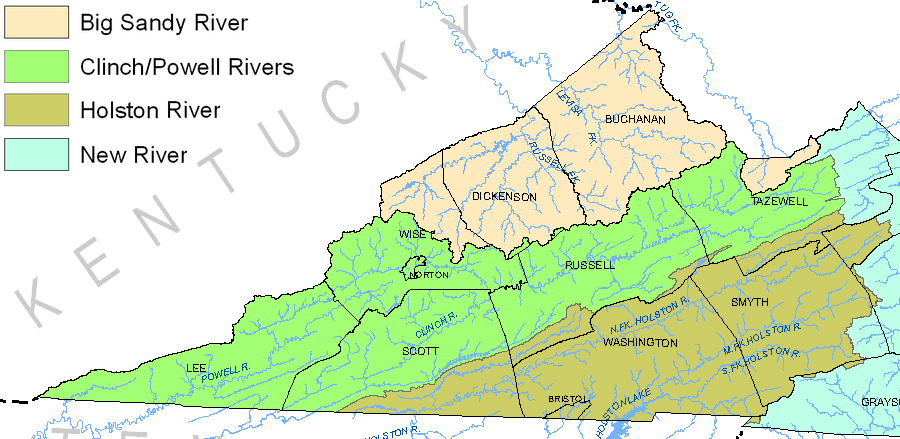
THE HOLSTON RIVER WATERSHED
Quick FactsThe Holston River flows through Southwest Virginia into Tennessee.
Three major forks make up the river, all of which flow through Washington County. The convergence of the Holston River with the French Broad River in TN forms the Tennessee River. Water from the Holston River Watershed will eventually make its way to the Atlantic Ocean. |
|
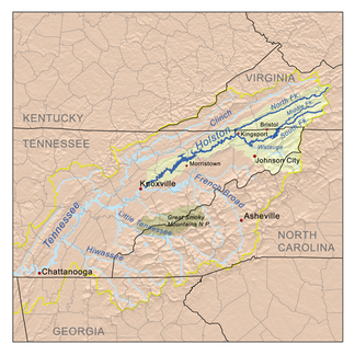 The Holston River Watershed flows into the Tennessee River Watershed. |
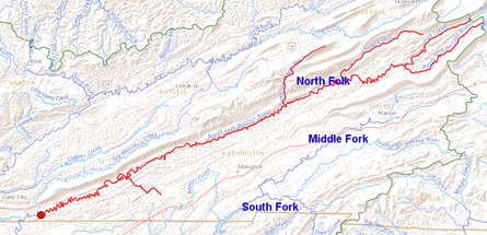
The three forks of the Holston River converge near the Va-Tn border.
100% of Washington County rainfall drains to the Holston River Watershed. This water eventually flows into the Atlantic Ocean.
|